All Features
Everything you need on the trail — from AI-powered intelligence to offline maps and community features.
🤖
AI Features
Six AI-powered features that make TrailNav the smartest trail app available. All processing on-device for privacy.
- AI Trail Assistant — chat about any trail, get instant answers
- Smart Route Builder — AI builds your perfect route from preferences
- AI Ride Insights — post-ride performance analysis
- AI Weather Advisor — go/maybe/wait riding recommendations
- AI Training Coach — personalized weekly training plans
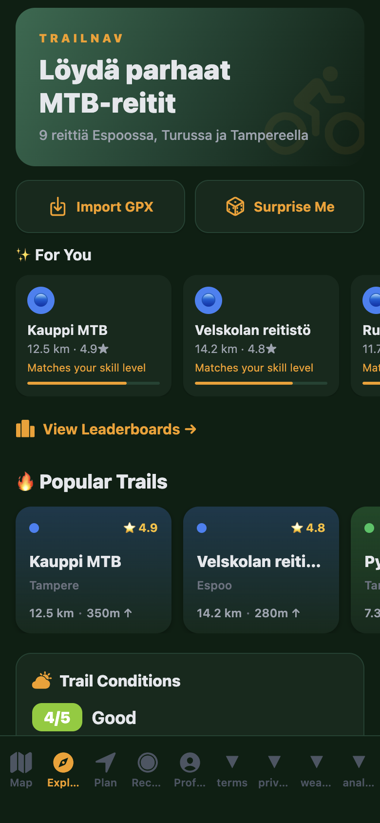
- AI Trail Discovery — "For You" personalized trail feed
Explore AI Features →
🗣️
GPS Navigation & Voice Guidance
Turn-by-turn voice navigation in 3 languages. Junction warnings, rerouting, and bike computer mode.
- Voice navigation: English, Finnish, German
- Junction warnings 50m ahead with haptic feedback
- Off-trail alerts with automatic rerouting
- Bike computer mode (full-screen stats)
- Route snapping and real-time progress tracking
📡
Offline Maps
Download maps for 30+ regions and ride without cell service. Trail data, navigation, and AI all work offline.
- 30+ downloadable regions worldwide
- Full navigation works offline
- Background tile caching with progress
- Storage management UI with region sizes
- Resume interrupted downloads
⛈️
Trail Conditions & POIs
Real-time trail conditions powered by community reports and weather analysis. 210+ points of interest along every route.
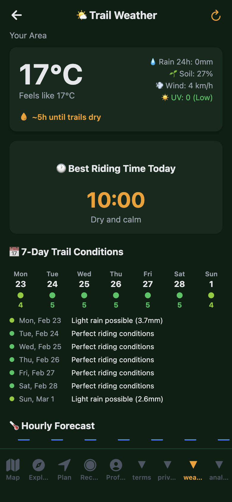
- Crowdsourced condition reports (Dry/Muddy/Wet/Snowy)
- Trail status: open / caution / closed
- Soil moisture & drying time predictions
- 210+ POIs: parking, water, bike shops, trailheads
- Community-submitted POIs
📝
User-Generated Content
Submit new trails, write ride reports, upload photos, and report conditions. Help grow the community database.
- GPX upload for trail creation with moderation
- Ride reports with photos and conditions
- Trail photo gallery with geotagging
- Community trail submissions
- Condition reporting after every ride
📊
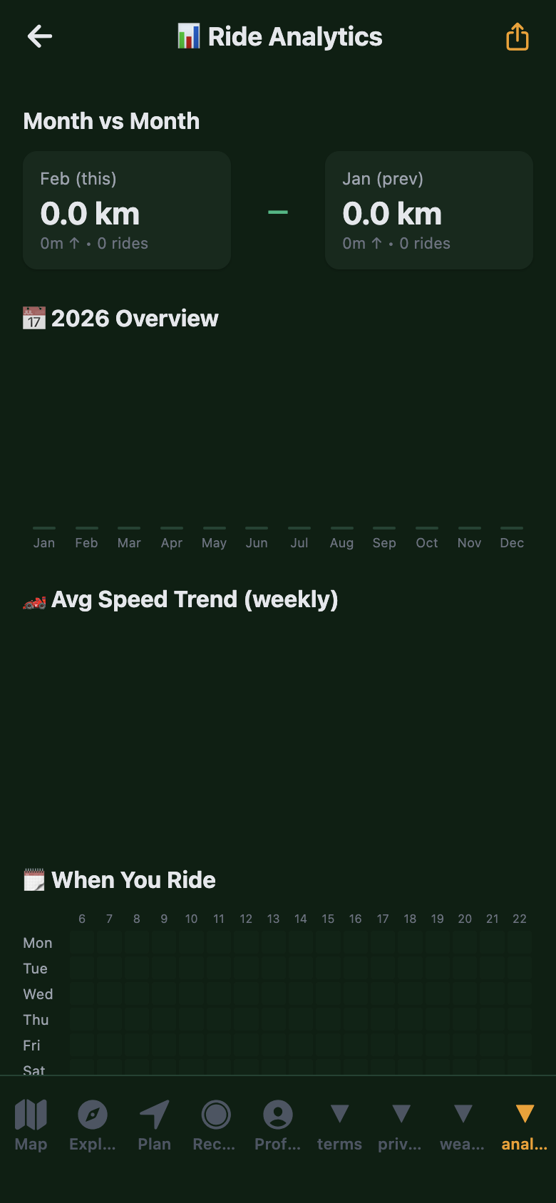
Ride Tracking & Analytics
Full bike computer with GPS recording, auto-pause, and detailed analytics.
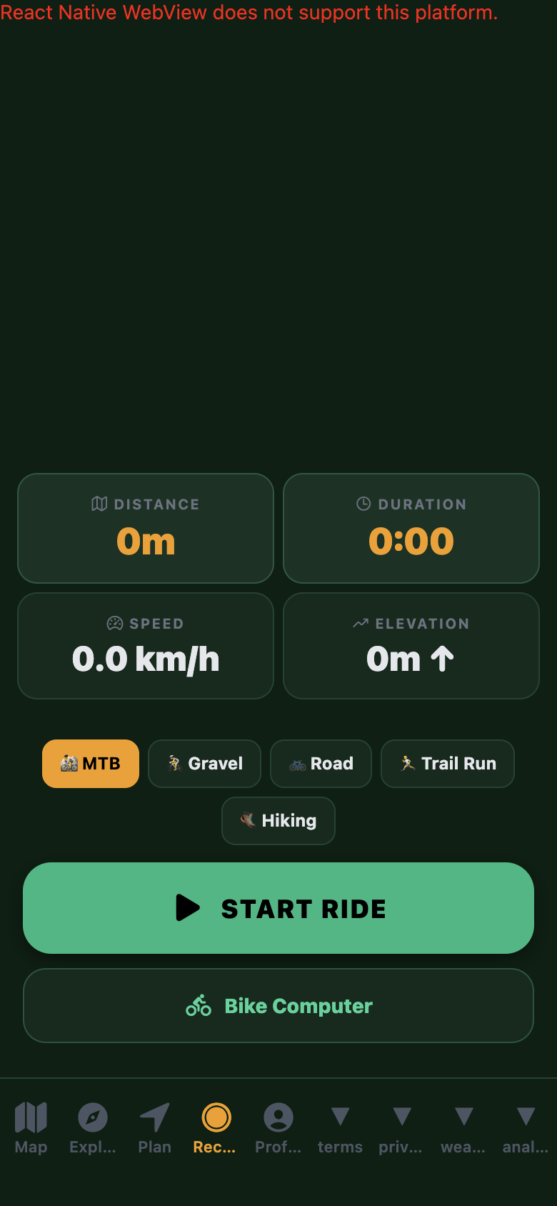
- GPS recording with live speed, distance, elevation
- Bike computer mode with large display
- Weekly/monthly/yearly statistics with charts
- Personal records: longest ride, biggest climb, fastest speed
- Multi-sport: MTB, Gravel, Road, Trail Running, Hiking
- Export: GPX, FIT, KML, CSV
👥
Social & Community
Activity feed, challenges, leaderboards, trail chat, group rides, and photo sharing.
- Activity feed with public ride posts
- Follow friends and see their rides
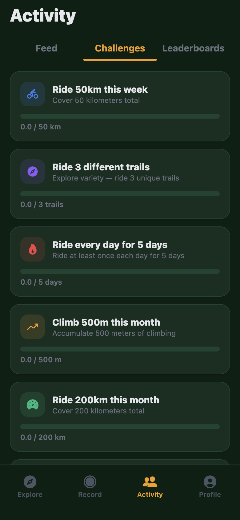
- Weekly and monthly challenges with progress bars
- Leaderboards: weekly km, monthly elevation, all-time
- Trail-specific chat channels
- Share rides & trails via deep links — one tap to open in TrailNav
- Trail photo gallery
- Trail reviews with 1–5 star ratings
🏆
Gamification & Achievements
18 achievement badges, daily & weekly streaks, seasonal challenges, and ride milestones.
- 18 badges across 5 categories: Distance, Elevation, Rides, Streaks, Explorer
- Daily & weekly streaks with grace period — keep your momentum going
- Seasonal challenges with limited-time rewards
- Weekly and monthly challenges with countdown
- Progress bars and completion tracking
- Ride milestones: 50km, 100km, 500km, 1000km+
🆘
Safety
SOS button, breadcrumb trail, retrace, and emergency contact management.
- SOS button: hold 3 seconds to send emergency SMS with GPS coordinates
- Breadcrumb trail: location saved every 30 seconds
- "Retrace" button to navigate back
- Configurable emergency number (default: 112)
📡
Integrations & Export
Real Strava import, Garmin FIT, Apple Watch, Siri shortcuts, Spotlight search, App Clips, and data export.
- Real Strava import — activities sync directly as rides
- Garmin FIT file import/export
- GPX, KML/KMZ, TCX, GeoJSON import
- Apple Watch companion app
- Siri shortcuts (4 actions: start ride, find trails, check weather, open route)
- Spotlight search — find trails from iOS search
- App Clips — preview trails without installing the full app
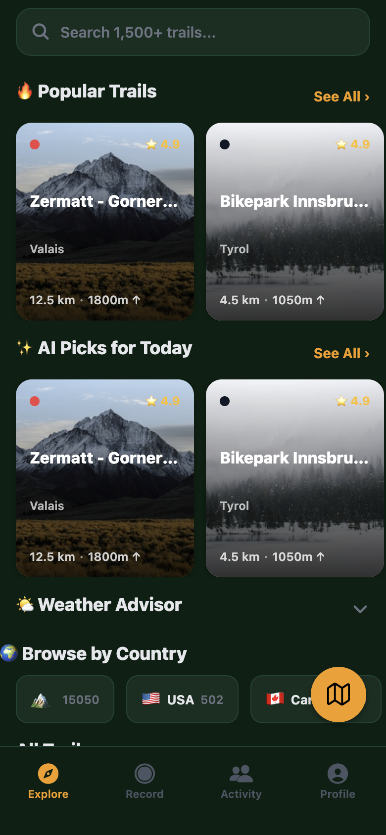
🗺️
Route Planner
Plan rides on an interactive map. Drop waypoints, snap to trails, and share your routes with anyone.
- Interactive map with tap-to-add waypoints
- Snap-to-trail for accurate routing along real trails
- Save routes with custom names and descriptions
- Share routes via deep links — one tap to open in TrailNav
- Works offline with downloaded maps
🌍
Multi-Language Support
TrailNav speaks your language. Full localization across all 76 screens in English, Finnish, and German.
- Complete UI in English, Finnish (Suomi), and German (Deutsch)
- Voice navigation in all 3 languages
- Localized trail descriptions and notifications
- More languages coming soon
🔔
Push Notifications
Stay in the loop with 7 notification types. Trail conditions, challenges, social updates, weather alerts — all with deep linking straight into the app.
- Trail condition updates for your favorite trails
- Challenge reminders and completion alerts
- Social notifications: follows, comments, ride shares
- Ride reminders to keep your streaks alive
- Weather alerts before your planned rides
- Maintenance updates and trail closures
- Event notifications for group rides and competitions
⌚
Apple Watch Companion
Real-time ride data on your wrist. Haptic turn-by-turn navigation, heart rate tracking, and glanceable stats — without pulling out your phone.
- Real-time speed, distance, elevation, and heart rate on your wrist
- Haptic turn-by-turn navigation — feel the turns
- Start and stop rides directly from Apple Watch
- Complication support for quick launch
💪
Health & Fitness
Sync with Apple Health and Google Fit. Track calories, heart rate, and workouts — and get a personalized fitness level assessment.
- HealthKit integration — workouts, calories, heart rate synced automatically
- Google Fit support for Android users
- Fitness level assessment based on your riding data
- Heart rate zones and training load tracking
📱
Widgets & Dynamic Island
iOS home screen widgets and Live Activity support. See your streak, last ride, or nearby trails at a glance — and track navigation in the Dynamic Island.
- Home screen widgets: current streak, last ride summary, nearby trails
- Live Activity for active navigation — see directions without unlocking
- Dynamic Island integration during rides
- Lock screen widgets for quick access